Via Flickr:
Great Blue Hill
From Wikipedia, the free encyclopedia
Great Blue Hill
Elevation640+ ft (195+ m)[1]
Prominence483 ft (147 m)[1]
Location
LocationNorfolk County, Massachusetts
RangeBlue Hills
Coordinates42°12′43″N 71°06′56″WCoordinates: 42°12′43″N 71°06′56″W[2]
Topo mapUSGS Norwood
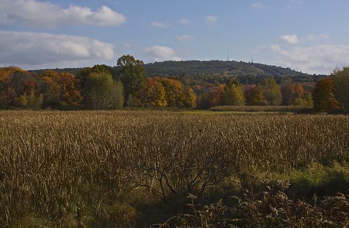
Great Blue Hill (Native Americans called it Massachusett) is a hill of 635 feet (194 m) located within the Blue Hills Reservation in Milton and Canton, Massachusetts 10 miles (15 km) southwest of downtown Boston. It is the highest point in Norfolk County. The modern name for the hill was given by early European explorers who, while sailing along the coastline, noticed the bluish hue of the exposed granite faces when viewed from a distance (due to Riebeckite). The Blue Hills's eastern slopes face the ocean and lie within Quincy. The area attracted quarrying for its "blue granite". The name of the Massachusett Indian tribe and their language (and thus the name of the Bay, Colony, state, etc.) derive from the Massachusett name of the hill: massa-adchu-es-et, where massa- is "large", -adchu- is "hill", -es- is a diminutive suffix meaning "small", and -et is a locative suffix, identifying a place.
Monday, October 21, 2013
Great Blue Hill
Subscribe to:
Post Comments (Atom)
No comments:
Post a Comment